

Risk Assessment and Mitigation in Cantera
 Sponsoring organization: Compañia para el Desarrollo Integral de la Peninsula de Cantera
Team members: Evan Lacroix (Civil Engineering ’18), Connor Mastropoll (Mecahnical Engineering ’18), Nathan McNeill (Biology & Biotechnology ’18), Tony Rodriguez (Actuarial Mathematics ’18)
Download the final presentation.
Executive Summary: Puerto Rico is a small tropical island in the northeastern region of the Caribbean Sea, and as such, it is remarkably vulnerable to natural disasters, most notably hurricanes, flooding, earthquakes, and tsunamis (Small & Nicholls, 2003, p. 2). In the island, larger disasters have the potential for catastrophic destruction; damages from hurricanes, flooding, and earthquakes combine to account for over 4.5 billion dollars of damages annually (“Puerto Rico Disaster & Risk Profile”, 2014). The capital city of San Juan has been pushing to minimize future impact of disasters through a variety of agencies, and has made significant progress in their campaign. However, some smaller communities that are vulnerable to disasters lack funding due to the economic stressors currently affecting the island government. For the underdeveloped community of Cantera, natural disasters have the potential to be particularly catastrophic due to the region’s geography, socioeconomic status, and inadequate disaster preparedness.
In order to address this issue, San Juan joined the 100 Resilient Cities initiative, which is an organization that promotes high-level, integrated urban planning to increase disaster resilience of coastal cities. This initiative highlights both the importance of a city’s ability to survive, adapt, and grow in the face of natural disasters (Berkowitz, 2016). Over the three years since its acceptance into the program, San Juan’s resilience program has created five community adaptation plans for five communities across the municipality.
For this project, we worked alongside La Compañía para el Desarrollo Integral de la Península de Cantera (CDIPC), a government organization that strives to improve the living conditions of the residents through community development. Since its inception in 1992, the CDIPC has accomplished many community-wide projects in Cantera, such as installing a new sewer system, and also creating better living conditions by relocating residents in the barriadas of Cantera into government subsidized housing. The barriadas are characterized by homes built on collections of waste along the shores of the local channel and do not adhere to construction codes nor have access to basic services and utilities. The CDIPC is now concerned with ways that residents in the barriadas can protect themselves and mitigate damages from natural disasters. This task revolves around the goal of improving the safety for the community members in the Cantera Peninsula.
Methodology
he overall goal of this project was to perform a risk assessment in the Cantera Peninsula and provide guidelines for mitigation of damages and the optimization of recovery for the community. This goal was fulfilled through the following objectives:
1) Interviews – Conduct interviews and meet with local, city, and national agencies to discuss region-specific issues
2) Assessment – Assess the disaster vulnerability of the Cantera community through a community walkthrough, mapping, and a survey of the residents
3) Development of Materials – Compile information on building techniques, flood insurance, and disaster preparedness and refine research findings into comprehensive guidelines tailored to the needs of the Cantera community
4) Distribution of Deliverables – Present findings and guidelines to the community and provide the CDIPC with resources to present, distribute and edit as they see fit
To provide context for the issues within the community, we conducted interviews in order to understand how we can help the Cantera community. These meetings gave our team a jump-start in terms of background and familiarity with the issues. The interviews we conducted included the CDIPC and its social workers, the Consejo Vecinal, the Municipality of San Juan, and a National Flood Insurance Program (NFIP) expert.
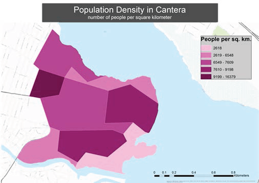
We were able to perform an assessment of disaster vulnerabilities in the Cantera Peninsula through the use of a community walkthrough, ArcGIS mapping, and a survey of the residents to explore their experiences with flooding and their knowledge of flood insurance. The walkthrough gave us a first hand experience of the quality of the infrastructure of the community. The ArcGIS software allowed us to present area hazards in geographic context and create informative maps that show community-specific vulnerability. Finally, the survey of residents allowed us to understand and quantify resident perception and awareness of flooding and flood insurance.
The team then compiled information on building techniques, flood insurance, and disaster preparedness and then refined those findings into a comprehensive resource packet tailored to the needs of the Cantera community. These findings included guidelines to improve the structural integrity of a household, flood insurance information, and basic disaster preparedness guidelines for the community.
The team then distributed the deliverables of a community presentation and script as well as an informational resource packet to the CDIPC to continue the education of residents using the team’s research, assessments, and products. This objective ensured that our findings were delivered to the residents of the neighborhoods in order to improve collective safety in the event of a large disaster.
Results
From the interviews conducted with the multiple agencies, we were able to identify the specific issues that revolve around the Cantera community. In order to elaborate on the issues in the community, we used ArcGIS software to create informative map overlays highlighting the specific vulnerabilities that encompass the region. This was useful to allow for a visual representation of the hazards in the community, as it refers to natural disasters. The results show that a majority of the Cantera Peninsula is in a multi-hazard vulnerability zone. These hazards being liquefaction, the 100-year flood, storm surges, and tsunamis. We used this mapping assessment to provide context for our basic disaster preparedness guidelines in our informative resource packet.
The survey conducted allowed for the team to quantify residents perceptions on flood insurance. It focused on determining the community’s understanding of their risk to flooding, their understanding of what flood insurance is and what it offers, and their willingness to get flood insurance. In order to distribute the survey, we consulted with the Consejo Vecinal who assisted in the editing of the survey and gaining responses. We analyzed the data and used the knowledge we received from the survey to tailor our flood insurance information guidelines within our informative resource packet to better assist the community.
We developed a community presentation, complete with a script, to be given to the CDIPC to be presented at later dates educating the residents on building techniques to mitigate damages during natural disasters, flood insurance information, as well as basic disaster preparedness tips. We identified this as a useful deliverable because it will be stored within the CDIPC and used for years to come to continue to educate the community and improve safety and resilience.
In order to supply the residents of Cantera a more informative deliverable than just the community presentation, we also supplied a resource packet. This packet includes guidelines to improve the structural integrity of a household, flood insurance information guidelines, and basic disaster preparedness guidelines. The first set of guidelines focus around finding affordable options to retrofit a structure, in order to improve its structural integrity and brace for a natural disaster. Information in the flood insurance guidelines is geared towards the importance of having flood insurance, and also showing how to apply for flood insurance and file a claim post-event. The basic disaster preparedness guidelines provide the reader with tips on what to do before, during, and after specific natural disasters such as earthquakes, hurricanes, and flooding, in order to improve the safety of the resident and their family. Based off of our interviews with
Recommendations and Conclusions
In conclusion, we assisted the CDIPC in assessing the vulnerabilities of the area and providing the residents with informational material to better prepare themselves and mitigate damages in the event of a natural disaster. Through this informational material, we have provided the CDIPC with the resources to continue moving forward with improving the general safety of their residents and mitigating physical damages. One of our key recommendations to the CDIPC was to encourage residents to obtain flood insurance, and to work with the municipality of San Juan to attempt to establish a community based insurance program. We also recommend that the CDIPC assist the community in retrofitting their homes to prevent damages from natural disasters by supplying trustworthy contractors and materials for the residents to utilize. Another recommendation for our sponsors is to continue to distribute and deliver our findings to the community, as we believe it is useful information for the well-being of the community.