

Executive Summary
Introduction and Background
Boston has become a model of urban revitalization (Anzilotti, 2017). Over the last 40 years, Boston’s population has grown 9.8% and the city has seen “nearly a 5 percent increase of office space” (City of Boston, 2018 & Boston Redevelopment Authority, 2014). The stress of this growth is readily apparent on the waterfront. Currently, Boston is facing conflict along the waterfront with competing options on how to redevelop land inside of the Inner Boston Harbor Designated Port Areas (DPAs). More than twelve percent of this land is vacant (Boston Harbor Now, 2018). The vacant spaces offer great opportunities to improve the city-port connection and help spur the creation of a 21st-century Boston Harbor. However, not everyone agrees on what should be implemented. Some wish to build public spaces like parks, some want regulations on these areas to be relaxed in order to build hotels or apartments, and some want to preserve the land for water-dependent use (Chesto, 2018).
Tensions about how to best utilize the vacant land can be seen in the planning for development of Dry Dock 4. One option is to build a waterfront park on this land (Reed & Hilderbrand, 2018), while another is to build a “floating hotel” (Peters, A., April 16, 2014), however, there is a resistance to these options from groups that would like to save this space for maritime dependent uses (Boston Globe, Sept. 17th, 2018). There is one big concern no matter what becomes of Dry Dock 4 and that is the effects of climate change. The waterfront areas within Boston harbor will be impacted by high sea level rise by 2070 and be subjected to high risks of flooding (MASSDOT/FHWA, 2018).
To resolve this set of complex problems, mixed-use has been proposed as a solution (Song & Knaap, 2004). Still, mixed-use has both downsides and benefits. The lack of affordable housing for the working and lower class is a common issue seen as a side effect of high-end mixed-use development (Krausse, 1995; Seasons, 2014). Traffic congestion is another common problem that comes along with mixed-use development (Erbil, 2001; Krausse, 1995). On the other hand, mixed-use, more specifically mixing green spaces within other uses in the area, enhance the physical and mental health of individuals who use the space (Astell-Burt, Feng, & Kolt, 2013). Mixed-use could also provide multiple purposes for a singular space which can bring multiple benefits into one area and utilize the space more effectively.
Vacant areas within Boston’s four Inner Harbor Designated Port Areas provide opportunities for innovative mixed-use developments. The four DPAs are labeled in Figure ES.1. However, there are regulations that limit certain types of development and use within the DPAs. DPAs are specially designated to preserve water-dependent industrial uses. Strict regulations lead to the conflict that Boston is facing today of balancing competing preferences for open space, preserving maritime industrial uses, and promoting economic development and tourism.
Boston Harbor Now (BHN), a nonprofit organization, is a leader in promoting a 21st Century maritime economy. Currently, BHN is initiating a conversation about how to add creative mixed-uses in the DPAs that will be able to satisfy multiple stakeholders, not alter the purpose of designated port areas, and promote climate resilience. To assist BHN, we explored innovations that allow for mixed-use in Boston’s Inner Harbor, while taking into account community needs.

Figure ES.1: Map of DPA Geography
Methods
The goal of this project was to provide guidance for implementing beneficial mixed-use developments in Boston’s Inner Harbor Designated Port Areas (DPA).
To accomplish this goal, we completed the following objectives:
- Objective 1: Generated a list of innovative waterfront mixed-use options for urban harbors.
- Objective 2: Determined perspectives about the port areas and waterfront uses within communities around the DPAs and obtain knowledge of DPA land and regulations.
- Objective 3: Defined and applied a set of criteria to compare different mixed-use options within each DPA.
- Objective 4: Developed case studies for implementing mixed-use options.
We used Google Maps to explore nine waterfronts of other cities. We identified what types of business’ and public spaces are available, as well as what physical features around the waterfront are like. To understand the opinions of local residents and business owners we contacted ten community groups and conducted semi-structured interviews on the topics of DPAs and mixed-use on the Harbor with representatives from four of the groups. Using these multiple sources of information, we developed eleven criteria to assess opportunities for mixed use options in the four Inner Harbor Designated Port Areas. Some of the criteria included water dependence, climate resilience, amount of space needed, and what supporting services would boost its effectiveness. An Abbreviated Criteria List is shown in Figure ES.2.

Figure ES.2: Abbreviated Criteria List
Findings
Our analysis resulted in eight findings about climate resiliency, open space, pollution, usage of DPAs and travel concerns due to development:
- Finding 1: As the City of Boston prepares to release its third neighborhood climate preparedness plan, the implementation of resilient projects along Boston Harbor and its industrial waterfront is a priority for stakeholders.
- Finding 2: Community groups are aware that DPAs are meant to serve a specific purpose, however, they feel that DPAs are too traditional and that the DPA framework should be modernized.
- Finding 3: The public is aware that there are vacant parcels in Boston’s Inner Harbor DPAs but they lack the context and understanding of the value of complex DPA regulations to advocate and participate in shaping the working port areas of the waterfront.
- Finding 4: As the number of vacant and available parcels diminishes, balancing open space waterfront developments and industrial uses becomes more critical.
- Finding 5: Affordable housing developments for Boston’s residents are not as common as high price housing developments.
- Finding 6: Toxins from decades of pollution in the harbor still linger in the soil, causing concern for health and safety for the public near the Mystic River DPA in case of flooding or severe storms.
- Finding 7: Increasing traffic due to over-development in South Boston is negatively affecting the shipping industry in the South Boston DPA
- Finding 8: Vacant lots are currently being used as parking as opposed to active DPA uses (Figure ES.3).
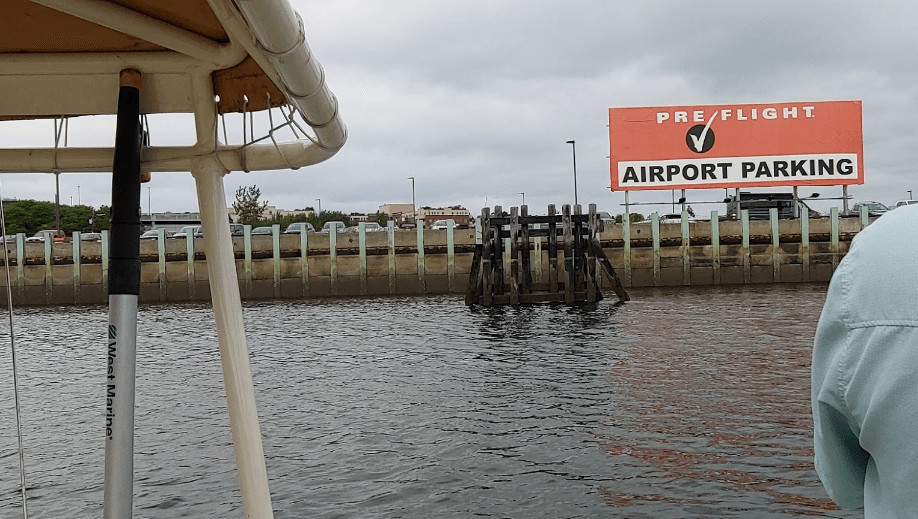
Figure ES.3: Chelsea Creek Parking Parcel
Recommendations
Our recommendations are twofold.
First, we recommend specific mixed-use development for particular parcels. We developed four case studies that match options with vacant parcels in the inner harbor DPAs to:
- Promote tourism by developing a historical site
- Increase recreation and leisure by constructing a beach
- Combat future flood risks by implementing climate resilient infrastructure
- Promote community use and access by building a community center
Second, we identified areas for further research that may benefit the DPAs and surrounding communities:
- Boston Harbor Now and other community groups should work together to investigate the concept of open space or the feeling of open space in areas that feel overcrowded or overdeveloped
- Boston Planning & Development Agency and Coastal Zone Management should evaluate the potential for a new tiered DPA system that allows for less restrictive use and development in some DPAs
- Boston Harbor Now should cooperate with other community groups to look into increasing public awareness of DPA regulations and opportunities
Conclusion
This project examined the issue of what to do with vacant DPA land. The rapid growth of Boston’s population, massive amounts of developments in the last decade, and an increasing concern about sea level rise have put stress on the city. This has been partially expressed through conflict on how to utilize the waterfront. DPAs represent a unique part of this issue, as they include vacant or underutilized land that is reserved specifically for marine based industry. DPAs are seen by some as needlessly restrictive, preventing development of something sought by the community such as the waterfront park proposed by the Boston Trustees of Reservation for Dry Dock 4, but as seen in our case studies, DPAs can provide for the community without undesignating parcels or by drafting a modified regulation plan for each DPA, effectively allowing a developer to disregard DPA regulations. The key to modernizing DPAs in parallel with the rest of Boston will be to educate the public on the benefits of DPAs, and to engage the community in conversation about how the DPA can provide for them which still serving its purpose to promote and preserve maritime industrial use.
Acknowledgments
Jill Valdes Horwood – Boston Harbor Now
Prof. Seth Tuler – Project Advisor Worcester Polytechnic Institute
Mystic River Watershed Association
Atlantic Works Gallery
Neighborhood of Affordable Housing
South Boston City Point Neighborhood Association
We would like to give our gratitude to our sponsor at Boston Harbor Now, Jill Valdes Horwood, for giving us the opportunity to work on this project and for all of her guidance and support.
We would also like to give our gratitude to our advisor, Prof. Seth Tuler, for all his great support and insight throughout this project.
We also would like to acknowledge all of the community group members whom we interviewed and would like to thank them for all of the information and insight that they have provided to us.
Finally, we would like to thank all of these people once again for their assistance in bringing this project to fruition.