

Executive summary
Introduction
Natural disasters have killed nearly three million people in the last 20 years, and the United Nations predicts disasters will become more lethal (United Nations International Strategy for Disaster Reduction [UN/ISDR], 2015). Warning systems decrease risk from these disasters by allowing robust community action before disasters occur. These systems tie together strategies for early detection, communication, and public preparedness as community preference and the expected severity of disasters require. In the Lower Hutt region of New Zealand, the implementation of these strategies for flooding do not meet the standards necessitated by the severity of flooding in the region or the preferences of the community, requiring the Greater Wellington Regional Council (GWRC) to revamp their systems in an effort called the ‘Flood Warning Improvement Project.’ Our role within this project is to collect feedback from the community on communication preferences and public preparedness as a pilot program for the wider project.
Background
In the last 20 years, 4.4 billion people have been affected by disasters at the cost of US$4.8 trillion, mainly affecting lower-income communities without resources to protect themselves. Given threats such as increased rainfall and rising sea level posed by climate change, disasters are expected to be more severe in the future. Due to this growing risk, protective measures, such as warning systems, must be implemented with an evolving understanding of the causes of floods, their effects on communities, and how to combat risks posed. Warning systems mitigate damages like these via three primary avenues: early detection, public notification, and public awareness and preparedness. Early detection involves detecting disasters before they occur, allowing citizens to prepare for and respond in advance of disasters. While it is important to send warnings well in advance of a disaster, care must be taken to ensure accuracy to prevent the public from responding in inadvisable ways to events which ultimately do not occur. Public notification is the process of alerting the community at risk of a disaster before it occurs, without which early detection is useless to the public. Public awareness and preparedness require knowledge of risks and readiness for disasters within the community, allowing effective responses after detection and notification. All these components must be implemented effectively in order for anyone of them to be effective in reducing damages from disasters.
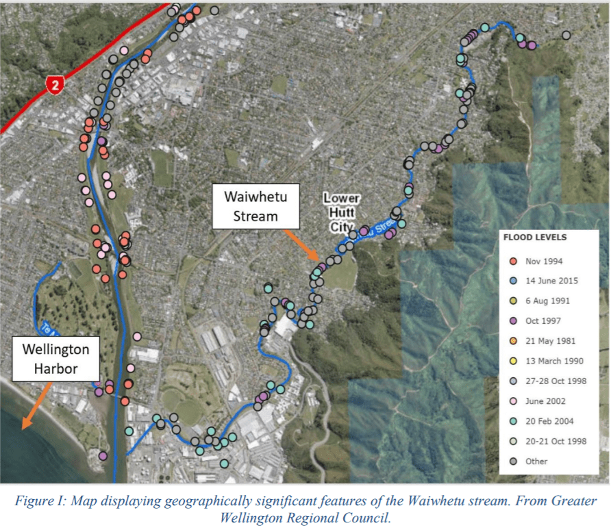
Flooding is New Zealand’s most costly natural disaster, in part due to the 18,000 kilometers of coastline and 350 estuaries, harbors, inlets, bays, and beaches on the islands. In the Hutt Valley, a flood along the Hutt River in 1976 caused over NZ$205 million in damages, and GWRC estimates that such a flood occurring today could incur damages in excess of NZ$1 billion. On the Waiwhetu stream in the Hutt Valley, which is prone to flooding due to its small size, surrounding land use, and it’s estuarial nature, another flood in 2004 caused nearly NZ$200 million in damages, making it an area of focus for GWRC.
Methods of communication used in Lower Hutt, such as texts, websites, door knocks, and social media, can reach much of the population, but not all, and studies on public preparedness for floods in the area indicate a lack of preparedness that could render warnings ineffective. Currently, organizations involved in providing warnings largely work separately and collaborate in cumbersome ways, with layers of officials sequentially interpreting the available data before issuing a warning. This creates a potential for delay and difficulties in communication. These organizations are exploring methods to decrease flood risk exposure in the region by revamping their warnings with defined plans, streamlining inter-agency collaboration, mitigating damages with infrastructure, and developing the “one-stop-shop” information portal proposed by GNS Science for the community and all organizations. The Waiwhetu stream will serve as the location for the pilot of this project due to its flood history and active community. Our purpose within this pilot will be to gauge community notification preferences and their level of flood preparedness and awareness.
Methods
To create recommendations to GWRC for this pilot, we researched how organizations can best provide warnings to and the extent of and how to increase public preparedness and awareness. To understand the roles of government organizations within flood warning systems and the characteristics of the stream, we conducted open-ended meetings with experts from GWRC, Wellington Region Emergency Management Office (WREMO), Wellington Water, MetService, GNS Science, and Friends of Waiwhetu (FW). In meeting with these organizations, we aimed to understand the limitations of warning systems
in the area, the roles of each organization within flood warning systems, and to refine our recommendations.
To understand communication preferences and levels of community preparedness and awareness, we conducted interviews and surveys (found in Appendix A) in-person and online. We issued surveys on platforms such as Facebook, Reddit, and Neighbourly in an effort to drive wide response and conducted in-person surveys to target local communities and control for access to technology. Interviews done in-person served as opportunities to broaden questions and themes from the survey and contextualize survey responses. To address public preparedness, an informational pamphlet covering various ways to be prepared for a flood, a strategy WREMO currently uses for earthquakes, was drafted and shown to community members in interviews to ensure it was properly informative. A draft of the public interface of a one-stop-shop was also created based on survey results of what the community wanted. We asked community members how they felt about these in our surveys and interviews.
Interviews were subject to content analysis with the use of a codebook devised deductively to capture ideas deemed useful in contextualizing survey data. Data from surveys were directly tabulated and cross-tabulated, often against demographic groups to investigate differences across groups.
Findings
We based our findings on 220 community surveys, nearly 27% in-person, and 18 interviews, the full demographic details of which can be found in Appendix E. Our findings include a preference for expedited warnings via Emergency Mobile Alerts and voice sirens, methods of structuring educational materials for flood preparedness such as pamphlets and websites, and a lack of awareness of flood risks.
Through meetings with stakeholder agencies, we affirmed they could more effectively work together to predict floods and notify the public using a “one-stop-shop” website. Through surveys, we found various perspectives on communication methods, such as a preference with 83% of respondents for Emergency Mobile Alerts (EMAs) among other options, though this varied by age and location. Along with EMAs, voice sirens, phone calls, and door knocks were also found to be preferable at night.

These data points showed the discrepancy between online and in-person surveys, with 87% of online and 66% of in-person respondents preferring Emergency Mobile Alerts. Other notification preference differences by survey method can be found in Appendix C, with few other distinct differences outside of notification preference. We also found a preference for a lead time above certainty in warnings being issued, with over half of those surveyed indicating they would like to be notified of a “severe flood” occurring within 10 hours even if it was 10% certain to occur, the lowest certainty included on the survey. The surveys additionally showed that over a third of respondents were minimally or not concerned about sea level rise and a quarter felt significantly at risk of flooding, indicating alongside interviews that there is not uniform awareness in the community to the various forms of flood risk such as current and imminent floods. In surveys, we found that only 13% of respondents felt fully prepared for flooding, and only 2 of the 18 interviewees indicated they were prepared. We also found that 42.9% of respondents, a plurality, were only willing to spend five to ten minutes preparing for a flood. To assist in remedying this lack of preparedness, we designed a pamphlet (Appendix F) and website (Appendix C) based on expert advice and community input on what would constitute useful information. The pamphlet and website provided information on what to do before, during, and after a flood as well as emergency contacts, a household emergency plan template, and other pertinent information regarding specific tasks to do during a severe flood. The website also would have information regarding other natural hazards along with current alerts and notifications.
Recommendations
We recommend the implementation of a tiered, redundant warning system, particularly stressing the use of Emergency Mobile Alerts, voice sirens if resources permit, and door-knocking and phone calls for reaching communities at night. We also recommend the implementation of GNS Science’s proposed one-stop-shop website with flood education materials, alerts, real-time graphics, and organization contacts for the public in addition to providing an inter-agency platform for the sharing and analysis of data and warning collaboration. We further recommend the distribution of an informational pamphlet by mail, the aforementioned one-stop-shop website, and social media to promote preparedness within the community around the Waiwhetu.
Conclusion
Our project was part of a greater five-year Floodplain Management Plan managed by GWRC. Even though the results and recommendations are specific to the Waiwhetu stream, the methods that we used can be implemented for other waterways as well. Climate change will continue to increase the frequency and intensity of natural disasters, but with the development of more robust warning systems, we can reduce the risk associated with these disasters.