Participatory Mapping to Empower Communities – La Perla
Project Sponsor: La Fondita De Jesús
Team Members: Jonathan Adams, Alexi Echevarria, Tai Le, and Humberto Torres
Project Advisors: Professors Leslie Dodson and Scott Jiusto
Project Files:
- WPI Mapping to Empower Final Report
- WPI Fondita Mapping to Empower Final Presentation
- WPI Fondita Training Workshop Presentation
- WPI Fondita My Maps Facilitator’s Guide
- WPI Fondita Registering Location User Guide
- WPI Fondita Project Team Journey Book
Abstract:
This project examined the benefits of participatory community mapping as a tool of community development in the historic San Juan neighborhood, La Perla. Data collection relied on interviews, stories, and drawings from individuals in the community to reach the goal of inclusion, transparency, and empowerment. The project team created multiple sample maps, such as an Arts/Murals map highlighting the beauty around La Perla and an Assets map highlighting strengths and areas for improvement, that reflected the desires of the community. We conducted training workshops on mapping software and created two guides on related mapping software. Through collaboration, this project built foundational relationships with La Fondita de Jesús, La Perla and WPI for future community development projects.
Executive Summary
Community development happens all over the world. However, that development will take on a different form depending on the community. In the case of our project, we used participatory community mapping as a tool for supporting community initiatives. Data collection for mapping relies on interviews, stories, and drawings from individual community members to reach the goal of inclusion, transparency, and empowerment (Parker, 2006).
Participatory community mapping has helped many diverse communities around the world. Puerto Rico has its own set of unique advantages and challenges, and our project sponsor, Corporación La Fondita de Jesús, saw participatory mapping as a promising idea. La Fondita was interested in exploring this approach with the pilot community of La Perla to facilitate participatory mapping strategies. Additionally, we saw an opportunity to help residents of La Perla use accessible mapping tools to identify the strengths of their community and determine areas they may develop.
Figure A: The municipalities served by La Fondita de Jesús (Corporación L.F.d.J, 2022).
La Perla, a small 650-yard-wide seaside neighborhood bordering Viejo San Juan (Old San Juan), has faced a stigma of being the “most dangerous neighborhood” in San Juan due to their marginalized, often violent history. Due to its low elevation and a defensive colonial wall that isolates the colorful small community from the rest of San Juan, La Perla is also susceptible to natural disasters such as tsunamis and hurricanes.
Over the centuries, La Perla’s population and community has been ever-changing. In the 1940s, “slum clearance” attempts to displace residents continued, and the population dipped from 4500 residents to 1200 residents (Vega Valdivieso, 2015, p. 15). In more modern times, a drug raid in 2011 displaced over 100 mostly male residents in the already shrinking displaced population (Vega Valdivieso, 2015, p. 18). After the raid, a fight for positive change was on the horizon within the community. This change was led by a new wave of mostly female local leaders lead through art, music, and tourism. The population residing in La Perla is estimated to be 350 residents living in about 200 households.
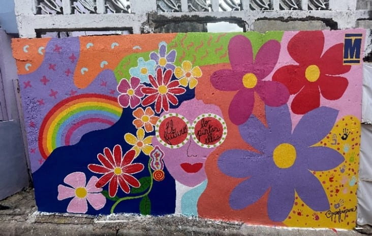
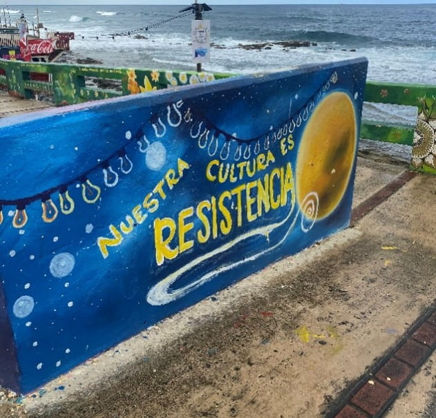
Figure B: Two murals in La Perla. On the left, the words “The future is painted by them” can be read in the center. On the right, the mural reads “Our culture is resistance”.
For a project such as ours to have a positive impact on a community, it is important that residents be deeply involved in the process. Meaningful participation encourages engaging with residents within a community and gives a deeper understanding of the experiences they live through and promotes relevant and sustainable outcomes (Geesteranus, 2022).
Goal and Objectives
The goal of this project was to work with residents of La Perla to develop data collection and mapping techniques that they and other communities can use to advance community initiatives. Furthermore, through communication and engagement with our sponsors and residents of La Perla, we aimed to build foundational relationships for future projects. We organized our work around the following central objectives to achieve these goals:
- Establish Familiarity with Residents of the Community
- Gather Information on What the Community Wants Mapped
- Create Sample Maps to Show the Capabilities of Mapping to the Community
- Provide Training Workshops on the Capabilities of Mapping
- Create Guides for Sponsors and Community Leaders for Future Mapmaking Activities
Project Outcomes
The community of La Perla was eager to learn mapping capabilities as they found it a useful tool for community development. Two findings of note were:
- Building Trust with Community Members Takes Time and Effort
The La Perla community was inviting to anyone who respected their community and wanted to learn about their culture and history. The sense of pride in their community was evident. However, not everyone is comfortable working with strangers. Not surprisingly, some residents did not want to speak or work with us. Although we invited anybody who wanted to work with us, we never pressured anyone to do so.
- Data Collection was Challenging
Data collection was difficult during the day as many community members worked in other communities. Residents at home often were understandably sensitive to visitors encroaching on their privacy. It was important for us to respect privacy, but this extended the data collection period. Further, cellular network connections in the area were weak, a challenge for online mapping.
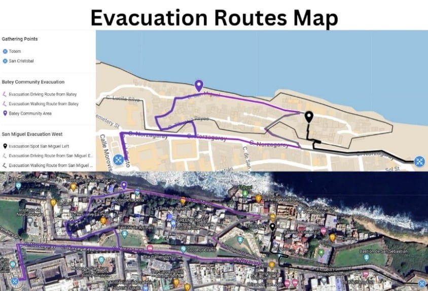
Key Project Outcomes included sample maps created using Google My Maps software to present as templates and ideas for La Perla and future mapping projects. Furthermore, we created guides and provided training workshops for anyone interested in mapping which enabled this project to live on once we left.
Figure C: Four sample map templates created using Google My Maps.
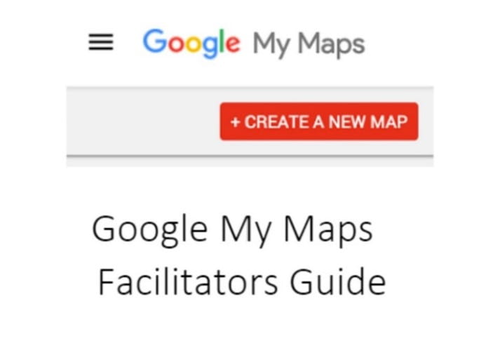
We found the trainings to be a crucial part as it allowed us to train individuals of the community and lay the groundwork for the continuation of the project once it came to an end. The workshops also allowed the team to further our knowledge of mapping and its role in community development. Understanding the limited time frame of the project, the guides on how to use Google My Maps as well as the guide on how to Register a Business or Location on Google Maps allow the project to live on once the project ended. Both training guides may be found and referenced on our project center website: https://wp.wpi.edu/puertorico/projects/2023-mar-may-2/fondita/.
Figure D: Cover pages for the two guides created.
Conclusions and Recommendations
As the first project team from WPI to work with La Fondita de Jesús and the community of La Perla, the main goal of this project was to communicate, engage and build foundational relationships. With the help of our sponsor, advisors, and the community of La Perla, the team was able to create maps using Google My Maps that reflected the ideas and voices of the community members. Further, the team created guides and provided workshops to teach mapping and its capabilities, allowing the project to continue after the team left.
Recommendations for Future Community Mapping IQP Project Teams
- Get involved with the community early and often. Identify important stakeholders and conduct key informant interviews as well as informal conversations.
- Be prepared to learn and re-learn in the field. Allow the community to guide the project and offer guidance when necessary. Hosting workshops and engaging events allowed the team to teach mapping capabilities to community members, but in a reciprocal spirit in which residents taught us about the subject matter.
- Create numerous sample maps prior to and once in field work for the community to visualize possibilities. Creating sample maps such as maps that highlight assets or different landmarks in your hometown will also allow the team to gauge the interest of community members regarding different types of maps.
Recommendations for working with the La Perla Community
- Understand positionality and its relation to your project and this community. Reciprocate the hospitality the community gives you and be open to working with everyone in the community. Be sensitive to sensitive information and understand the questions you may ask before asking. Provide clear explanations for what type of work you are doing in the community and where any information they provide you with will go.
- Work closely with a co-researcher who can translate conversations. Most La Perla residents speak Spanish. Having a translator with you will be important but be prepared for times when you will be on your own. Community members are more comfortable when speaking Spanish and are more likely to work with you as well.
Recommendations for the PRPC
- Consider future projects in collaboration with La Perla such as working alongside Jerome at the Finca Escuela de La Perla, with La Junta on furthering emergency preparedness plans or similar community development projects.
- Consider future projects in collaboration with La Fondita de Jesús such as work in other municipalities they serve. La Fondita offers many services to vulnerable populations around the island. They are a prominent organization with goals that align with the goals of the WPI Puerto Rico Project Center regarding sustainable community development.


